Well, we actually got out of bed a couple hours ago, shortly after noon today, EDT, but that is still before 7am Hawaii Standard Time, or 10am PDT, and we are still somewhere in between those time zones biologically….
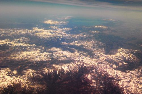
So, here is a review of our trip home from San Francisco yesterday: Apparently, there were weather issues in the eastern half of the country, even before we left SFO before noon PDT. Our captain told us we were being rerouted and it would increase our flight time slightly because of the weather. We ended up flying northeast out of California, after passing to the south of Lake Tahoe:
Sierra Nevadas Lake Tahoe
 |
From this point we traveled across Nevada, and if you look closely at the picture below, you can see a line crossing the desert diagonally that is Interstate 80 passing through the Dugway Proving Grounds to the west of Salt Lake City. (GPS data used to determine position during flight).
Dugway Proving Grounds, Utah I-80
 |
From there, we passed almost directly over Salt Lake City, less than 10 miles north of the city, with a nice view of the Great Salt Lake and the mountains to the east of the city:
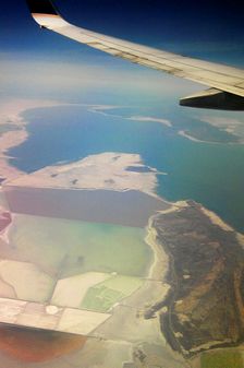
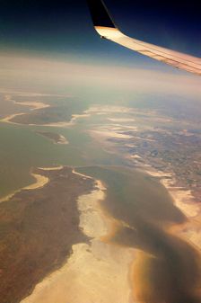
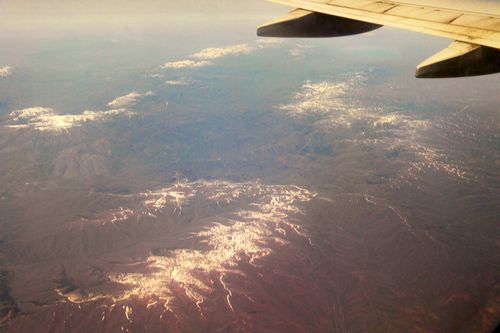
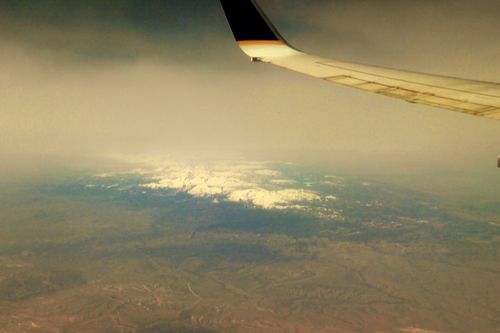
Passing through Wyoming, we caught a view of the mountains before it started to get cloudy.
Wyoming Mountains
 |
The eastern half of the trip was mostly cloudy, with little of interest visible for photography. It cleared up a little bit near Rapid City, South Dakota, but the one biggest cloud in the sky was positioned directly over what the GPS determined to be Mount Rushmore, so no view of the monument from 39,000 feet….
However, this is when the interesting GPS information was saved in the form of screen shots.
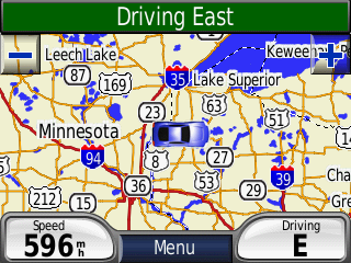
This screen shot is the northern most point of our travels between San Francisco and Newark. We traveled north almost to the Canadian border, passing north of Minneapolis before turning east towards Lake Michigan. Notice our flight speed, it only goes up from here as we catch a huge tailwind.
Zoom Zoom – We’re in the Jet Stream!
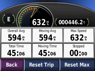 |
This is a screen shot of our maximum speed during the flight. We were traveling over Lake Huron heading into Canadian airspace. We had to be right in the jet stream, as the top airspeed of a 737-800 is somewhere around 560 mph, so add on a 130 jet stream tail wind pushing us along.
Crossing Ontario Canada
 |
This is our passage over Southern Ontario, on our way back to New York State and Newark’s Liberty Airport. We actually passed right over Syracuse on our passage to Newark, but the GPS battery went dead shortly after this screen shot, so I could not get a snapshot of that event.
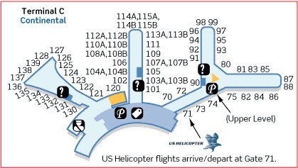
After we landed in Newark almost on time, just a couple minutes late, we had a hike from gate 94 to gate 111. They sound close together, but it’s a walk all the way from the end of one gate wing to the central hub, around the hub to the next wing, and almost all the way out to the end of that wing. Plus, it was fairly hot in the terminal, so we were both pretty heated up when we made it to Gate 111. The map below (from Continental’s website), will give you an idea of the walk…
After this, we boarded the flight to Syracuse. I detailed the problems in the blog entry last nigh with this flight, but we were only delayed about 35 minutes on the tarmac, and arrived in Syracuse almost on time as well, somewhere around 10:45pm. However, it took a good half hour to get our luggage, and by the time we go to our car and down the street to McDonald’s to get something to eat, they were almost closed for the night (not a 24 hour location), they close inside at 11pm, and drive thru at midnight. I think it was 11:50 when we pulled away from the drive thru. We finally pulled into the driveway about 1am, and got settled in bed and to sleep about 3am this morning…
This may be the final post for this trip, but I may add something in the next couple days if I find some interesting pictures to post to the blog from the digital camera. I may also note when all the pictures are added to the web photo album, hopefully in the next month or so…. Wow, it took me an hour to create this post….